NASA Satellite Data and Virtual Farm Models Transform Iowa Agriculture
NASA's satellite monitoring and virtual farm models give Iowa growers real-time insights and scenario testing to improve yields and water use.
Agriculture
*TL;DR NASA combines satellite‑derived soil‑moisture maps with virtual farm simulations to help Iowa producers plan for weather extremes and improve crop outcomes.*
Context During Washington Watch 2026, NASA’s Earth Science director Karen St. Germain highlighted how space‑based observations are now a daily tool for Midwestern farms. While the Artemis program captures headlines, the agency’s decades‑long Earth monitoring network quietly feeds data into local decision‑making.
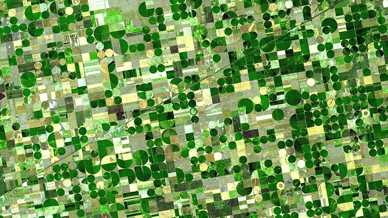
Key Facts NASA’s satellite fleet, including the Landsat and Sentinel series, measures vegetation health through a metric called NDVI (Normalized Difference Vegetation Index), tracks soil moisture using microwave radiometers, and estimates aquifer levels from gravity‑field changes. These datasets feed the U.S. Drought Monitor and the USDA’s World Agricultural Supply and Demand Estimates (WASDE) report, creating a comprehensive picture of field conditions.
The Virtual Agriculture Innovation Laboratory (VAIL) builds a digital twin of a specific farm using the same satellite inputs. Farmers input management choices—such as planting dates, fertilizer rates, or irrigation schedules—and VAIL runs the model under multiple weather scenarios generated from historical climate records and forecast ensembles. The output shows projected yields, water use, and economic returns for each scenario.
In a pilot across 12 Iowa counties, VAIL simulations revealed that adjusting planting dates by just three days could raise corn yields by 4 % under projected 2027‑2030 temperature trends. Soil‑moisture alerts derived from satellite data allowed participating farms to reduce irrigation by 12 % without sacrificing yield, conserving an estimated 1.8 billion gallons of water.
What It Means By delivering near‑real‑time field metrics and allowing growers to test strategies before planting, NASA’s integrated approach reduces guesswork and mitigates risk from climate variability. The ability to anticipate drought stress or excess moisture helps farmers allocate resources more efficiently, potentially adding millions of bushels to the state’s annual output.
Looking ahead, the expansion of VAIL to other crops and its integration with emerging satellite constellations promise even finer‑scale forecasts. Stakeholders will watch how broader adoption influences regional supply chains and whether the model can scale to the national level.
Continue reading
More in this thread
Conversation
Reader notes
Loading comments...